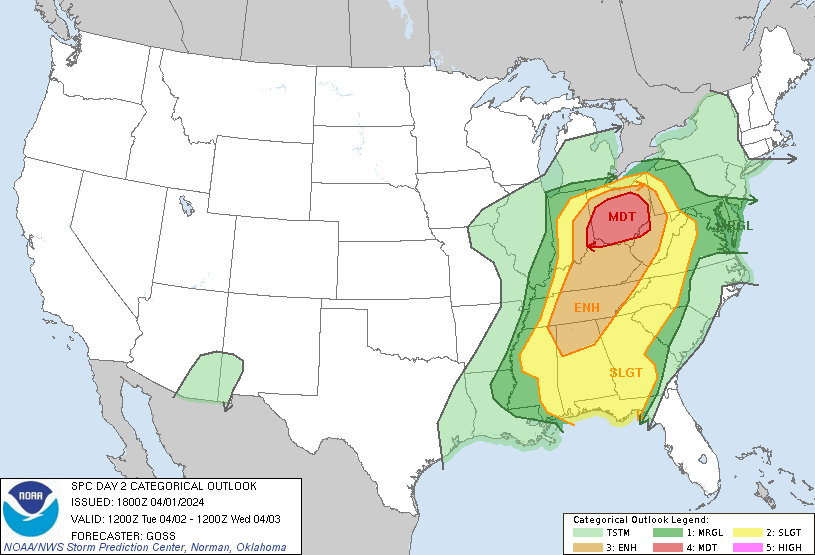
We’re about 20 hours away from a potential severe weather episode across the state—all modes of severe weather including damaging winds, large hail, and tornadoes. The primary threat will be damaging straight-line winds of 60-70 MPH with any thunderstorms.
OVERVIEW:
…SUMMARY… A potentially substantial severe weather outbreak — possibly including a few significant/long-track tornadoes — is evident for Tuesday afternoon and evening, with highest probability centered over the Ohio vicinity, and extending southward across the Tennessee Valley. Some severe risk exists as far south as the Gulf Coast, and as far east as western portions of Virginia and the Carolinas.


In terms of timing, thunderstorm development will begin around 2-3 pm across north Alabama

By 5:00 PM, thunderstorms are more numerous across north Alabama:

By 8:00pm, thunderstorms will begin to develop across central Alabama as well

Followers are advised to stay weather aware over the next 24 hours regarding this weather situation. Stick to your favorite local media outlet and internet sources.
