Confidence continues to increase on the potential for high snowfall probabilities across the northern third of Alabama. See the slides below for the details, and read the text for what to expect.
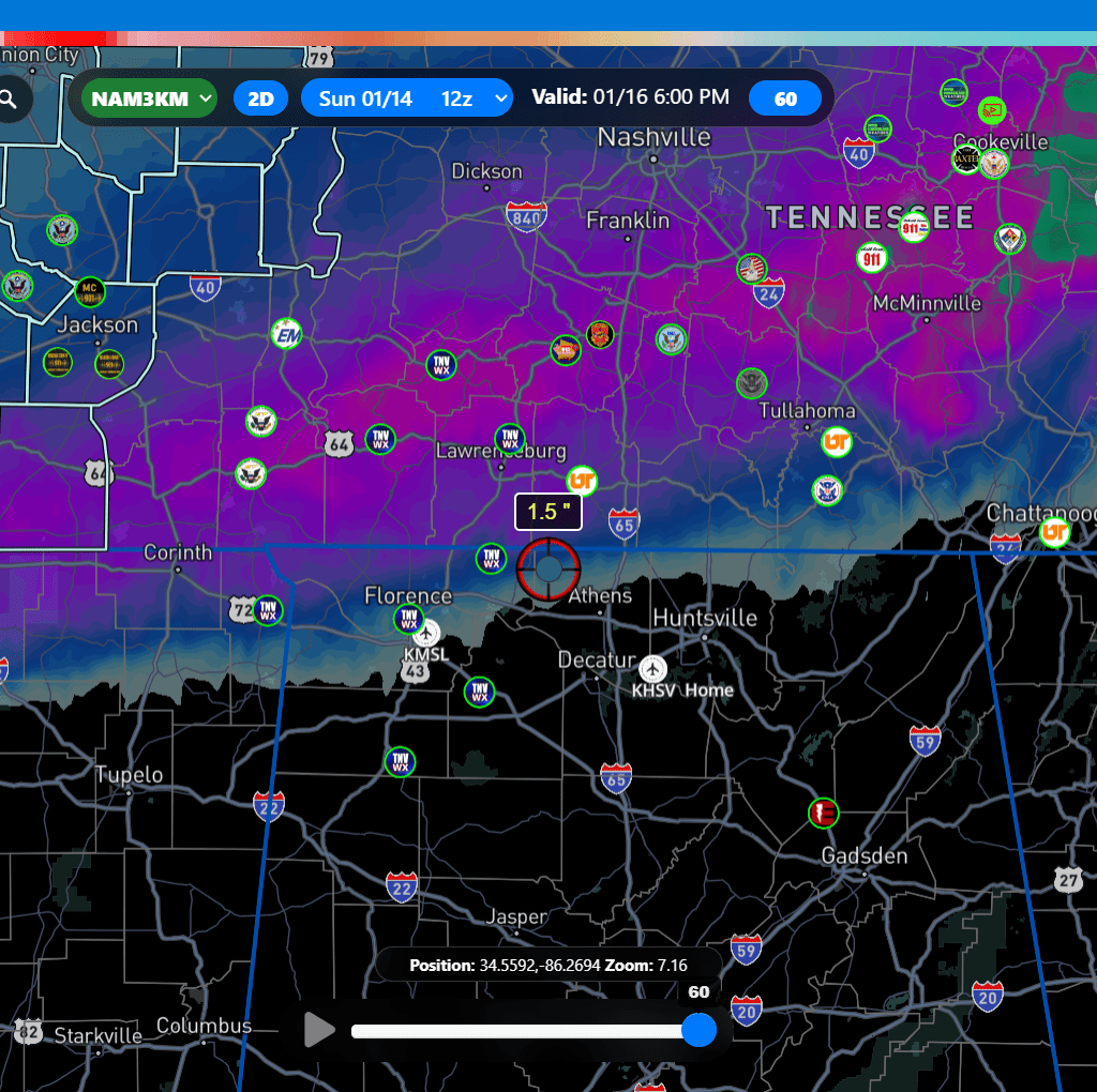
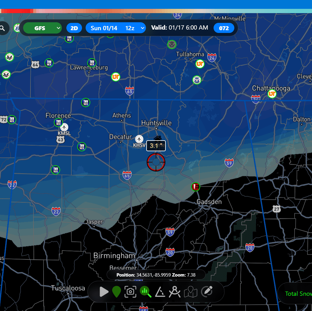
WINTRY PRECIPITATION ARRIVES THIS EVENING: Precipitation will start as a mixture of sleet and freezing rain and at times mix with snow as early as 5:00 PM in the Shoals, spreading east across north Alabama through the pre-dawn hours of Monday. The wintry precipitation does not come to an end until Tuesday morning. Measurable snowfall amounts of 0.5″ begin around midnight, when the Winter Storm Warning goes into effect. Total snowfall accumulations range from 1-5″.
TEMPERATURES PLUMMET: Temperatures will drop below freezing around midnight, causing any precipitation that has melted to re-freeze. Temperatures do not get above freezing until Thursday
PREPAREDNESS: This has been a talk for a long time, and it should come as no surprise. Protect the “3 p’s”, people, pipes, and pets!
- PEOPLE! Check on elders, and make sure they are warm. Use your local media station to find warming shelters if needed. Prepare for power outages, and ensure people are kept warm. Have extra blankets.
- PIPES! With prolonged sub-freezing temperatures, water in pipes could freeze and burst if precautions are not taken. Cover outdoor plumbing, drip faucets (both hot and cold), open cabinet doors, set your thermostat to at least 65, and allow air to flow. If you notice a compromised pipe, know how to shut the water off.
- PETS! Do not allow pets outside for an extended period.
TRAVEL:
If you must travel, prepare for the worst and hope for the best. ALDOT is already monitoring major interstates and highways, and local cities are doing the same. Know before you go with the Algotraffic app. Be sure to monitor local media and stay tuned with the current road conditions.