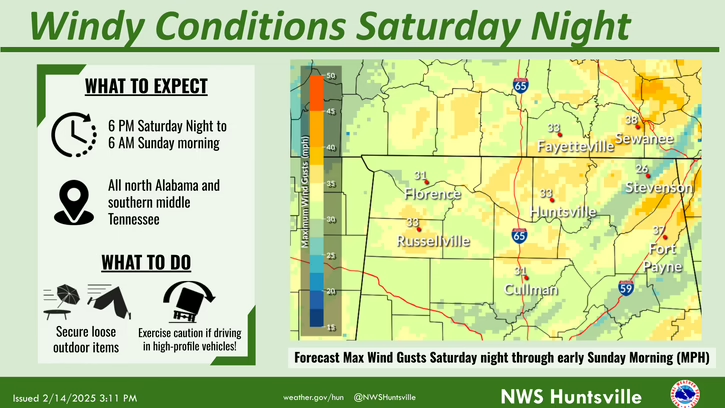
SATURDAY/SATURDAY NIGHT/SUNDAY MORNING
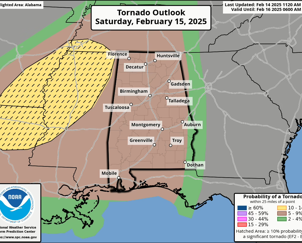
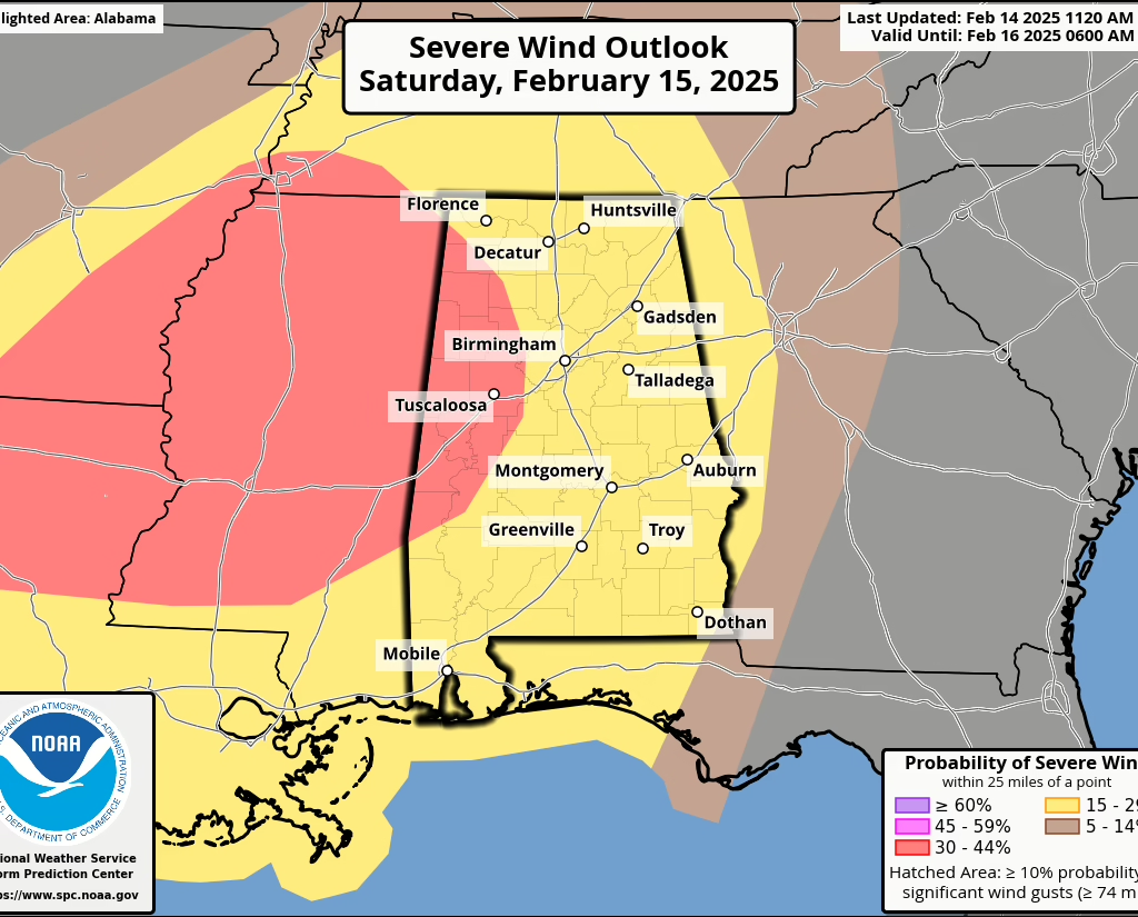
Windy conditions will arrive in the evening ahead of a severe line of storms. The storms are anticipated to arrive around 10pm and progress to the east. Damaging straight line winds of 60-70 MPH, a few brief, isolated tornadoes and flash flooding will all be possible with this line.
Additional rainfall in addition to rainfall we received this week will agitate creeks and rivers and elevate the flash flooding threat. Saturated soils will make trees more likely to fall, also elevating the damaging wind threat.