SUMMARY: A risk for strong to severe storms exists this afternoon and Monday afternoon, but the greatest risk will be Tuesday afternoon/evening where all modes of severe weather appear possible.

Today: Sunday
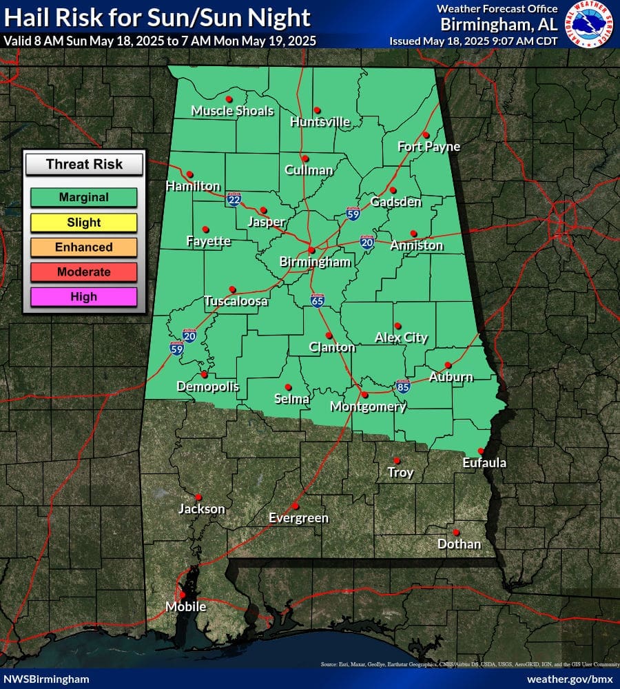
A risk for thunderstorms exists this afternoon, some of which could be strong with gusty winds and small hail. The risk for any storm becoming severe is relatively low but not out of the question. A large portion of central Alabama experienced severe storms this morning and the ground is soiled, so a risk of Excessive Rainfall is present for these areas.
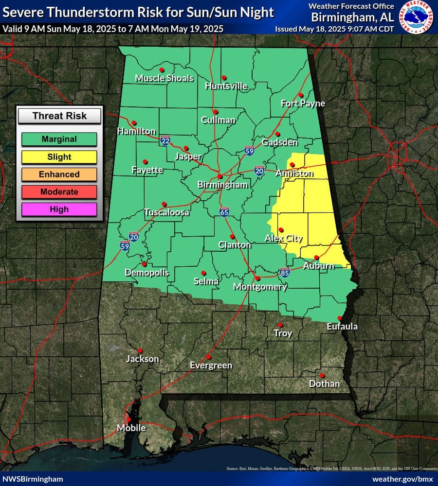

| Marginal (Severe) | Isolated severe thunderstorms possible. |
| Slight (Wind) | 15-30% chance of severe wind gusts (58 mph or greater) within 25 miles of your location. |
| Marginal (Hail) | Up to 15% chance of 1″ or larger hail within 25 miles of your location. |
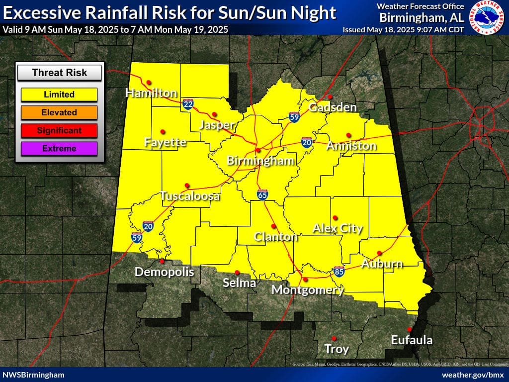
| Limited | Isolated flash floods possible. Most flooding will be localized to areas that can experience rapid runoff with heavy rainfall. |
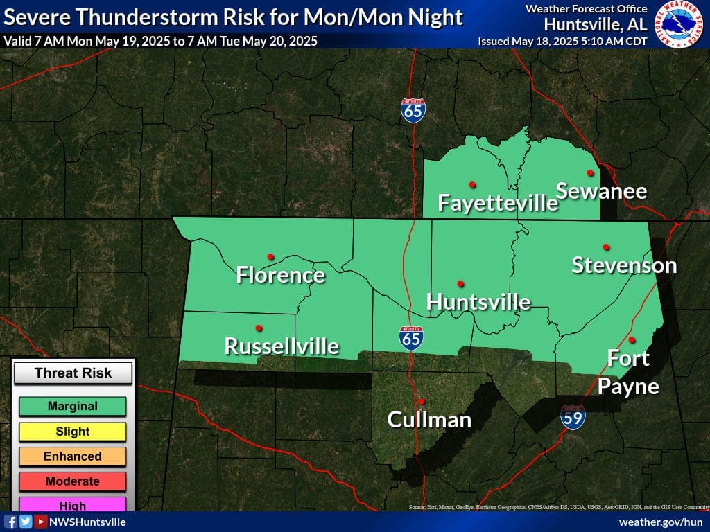
Monday
The risk for severe thunderstorms will be confined to the northern half of the state Monday afternoon. The risk is only Marginal and confidence in this is low.
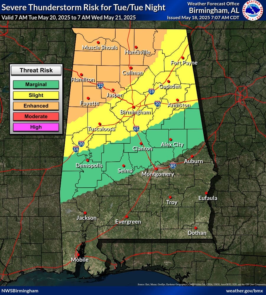
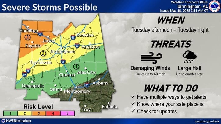
Tuesday
The risk for severe weather increases Tuesday afternoon and evening statewide. It appears damaging winds and large hail will be the main threats but there is a risk for flooding and tornadoes as well. The overall timing of this scenario is relatively low, but the risk for these hazards is high.