OVERVIEW
A strong storm system continues to surge across the continental U.S, producing a line of severe thunderstorms across AR/LA/TX, and wintry weather from IN/KY/WV/VA. There are currently Mesoscale Discussions in place for the wintry weather across this region, and there have been numerous media reports of ice/sleet in KY and surrounding states.
Closer to home, a Tornado Watch is in effect for the AR/LA/TX region as a line of storms marches to the east.
LOCAL ADVISORIES IN EFFECT
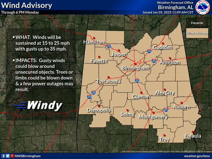
For north and central Alabama, a Wind Advisory is currently in place for winds outside of thunderstorms that may exceed 30 MPH.


SHORT-TERM: NOW THROUGH MIDNIGHT
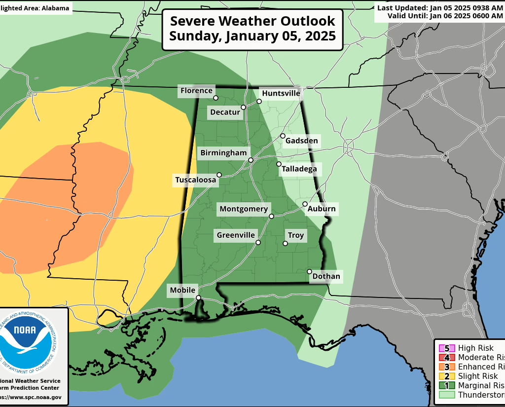
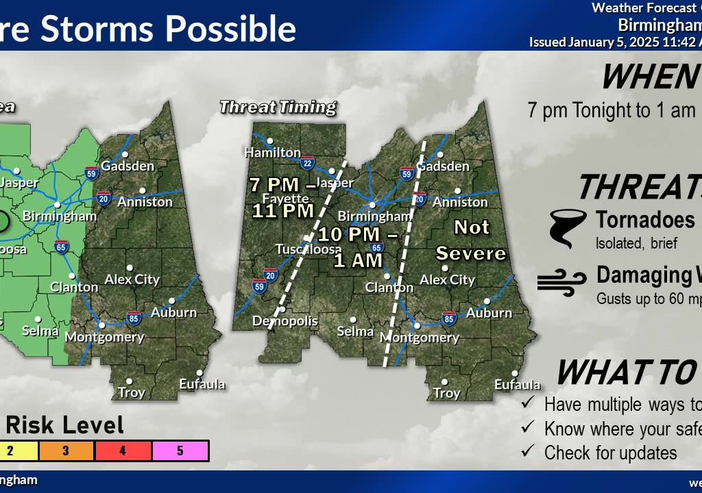
This line will race across the region and is expected to reach the AL/MS state line by 6:00 PM this evening. The air over Alabama is relatively stable, so the threat for any widespread severe weather is marginal, however, the combination of wind shear and a strong upper-level trough will overcome these dynamics and could cause storms to become elevated in nature, bringing a small chance at a strong/locally damaging wind gust threat and a tornado. This is highlighted in the Storm Prediction Center’s Outlook.


NEAR-TERM: MONDAY THROUGH WEDNESDAY
Cold air will rush in behind the line of storms, and there may be some snow flurries on Monday morning. However, since temperatures will be above freezing – little if any – accumulations are expected, perhaps a light dusting on elevated surfaces.
Temperatures will plummet statewide throughout the day on Monday, with high temperatures occurring in the morning hours. An extended period of below-freezing temperatures will occur throughout this week, amplifying the risk for cold-related illnesses. Temperatures will not rise above freezing until the early part of NEXT WEEK (January 13th).


EXTENDED OUTLOOK: FRIDAY’S WINTRY MIX POTENTIAL
This has been talked about for a long time and is something we have watched for the past 12-14 days. There was very little consistency on model-to-model run, and there still is, however since we are edging closer is it worth noting.
A system in the Gulf of Mexico will pump moisture into the southeast on top of our fridig conditions. There remains some uncertainty, such as:
- How far will the system track?
- How strong will it be?
- How much moisture will it lift?
- Will there be a “cut-off” of moisture?
- Where will the melting later be? — this has been a distinct challenge in the past, where snow turns into rain. For example, it could be snow in Huntsville and all rain in Cullman.
Despite these uncertainties, it won’t take much for any liquid to freeze on bridges, overpasses, and roadways. We could see something, or nothing. The trend is more towards a “something”, though.
This is 5-days out, but as we always say, it’s better to be prepared.


PREPARE AND PLAN
In the short-term (for the rest of the day)
- PLAN for gusty winds before the storms arrive. Secure all loose, unsecured items including holiday decorations.
- PREPARE for power outages
MONDAY-THURSDAY
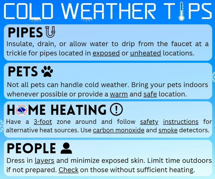
- PLAN for a prolonged period of subfreezing temperatures. Leave faucets dripping to prevent freezing. Cover all outdoor plumbing, sprinklers, etc.
- PREPARE the cold by dressing in warm layers. Wear a hat and gloves. Temperatures of this degree are dangerous to the human skin and lungs.
FRIDAY
KEEP CHECKING ON THE FORECAST.
We are not 100% sure what is going to happen. Hope for the best, prepare for the worst.
PLAN for wintry precipitation
