
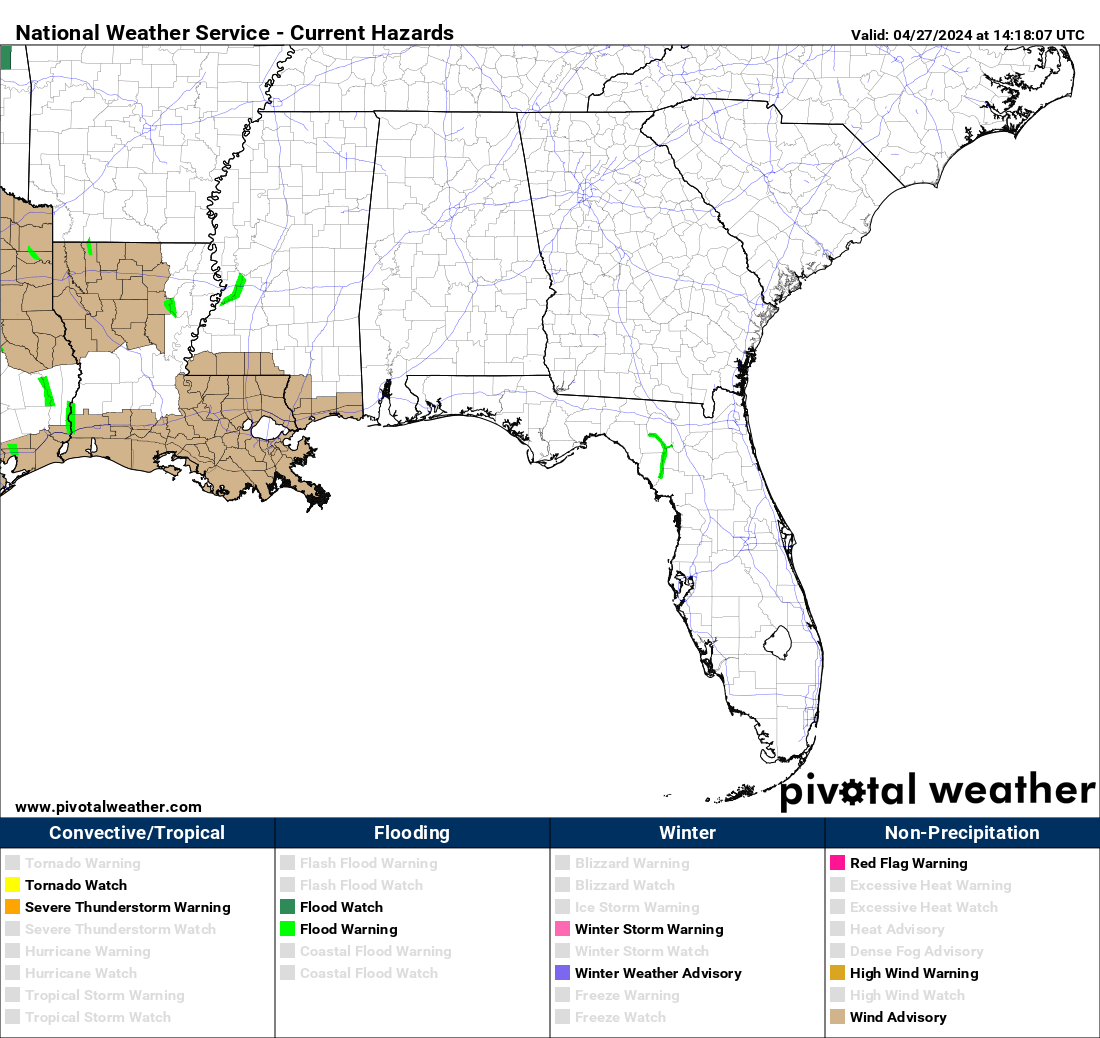
The latest map of hazards for our Coverage Zones and nearby areas. The map updates every minute. Navigate to our Severe Page to see severe weather updates in one place. ⬇️
Severe Weather Chances Daily With Highest Chances Tuesday
SUMMARY: A risk for strong to severe storms exists this afternoon and Monday afternoon, but the greatest risk will be Tuesday afternoon/evening where all modes of severe weather appear possible. Today: Sunday A risk for thunderstorms exists this afternoon, some of which could be strong with gusty winds and small hail. The risk for any…
NOAA Weather Radios in Central Alabama to Be Offline Next Week
Public Information Statement National Weather Service Birmingham AL 1249 PM CDT Thu May 15 2025 …NOAA WEATHER RADIO OUTAGE DUE TO A SOFTWARE UPDATE NEXT WEEK… The National Weather Service in Birmingham will be conducting a required, scheduled update to their Advanced Weather Interactive Processing System (AWIPS) system from May 19 through approximately May 21.…
Active Weather: Flash Flood Watch In Effect; A Few Strong Storms Possible Through Tuesday
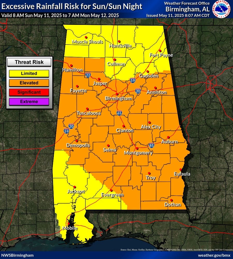
Today and Monday’s Excessive Rainfall Outlook A Limited Risk of Excessive Rainfall is in place for central Alabama, where grounds are already saturated from previous days of rainfall. For the rest of the state, a Limited Risk for Excessive Rainfall is in the Outlook. LimitedIsolated flash floods possible. Most flooding will be localized to areas…